
 Svenska
 Dansk
Dansk
 Suomi
Suomi
 Español
 Deutsch
 Français
 Italiano
 Nederlands
 Polskie
 Norsk
Norsk
Cart
Your cart is empty, but doesn't have to be..
Discount: 0.00 EUR
Digital Skipper |2/09, 2024
Raymarine displays can show several different types of wind data, which sometimes causes confusion. Here we explain what each type means and what additional data is required to calculate them. We use English terms (AWA, AWS, TWA, TWS, GWD, GWS) as they are standard in sailing and reduce the risk of misunderstanding.
Angle (e.g., Apparent Wind Angle, AWA) is relative to the boat's bow (0–180° port or starboard). Direction (e.g., Ground Wind Direction, GWD) is relative to north.
AWA and AWS are standard data on wind instruments like the Raymarine i60. These are measured directly by the masthead sensor and are affected by the boat's movement. Example:
TWA and TWS are wind over water, not over ground. Calculated from AWA, AWS, and speed through water (STW). GPS speed (SOG) is not sufficient. For TWD (True Wind Direction), compass heading and STW are required. Multifunction displays and i70/i70S show these values.
GWS and GWD are wind over ground, as you would measure from the dock. Requires AWA/AWS, GPS COG/SOG, and compass heading.
Sailing takes place in water, not on land. Ground Wind can differ greatly from True Wind in currents or tides. Therefore, sailing instruments show True Wind as standard.
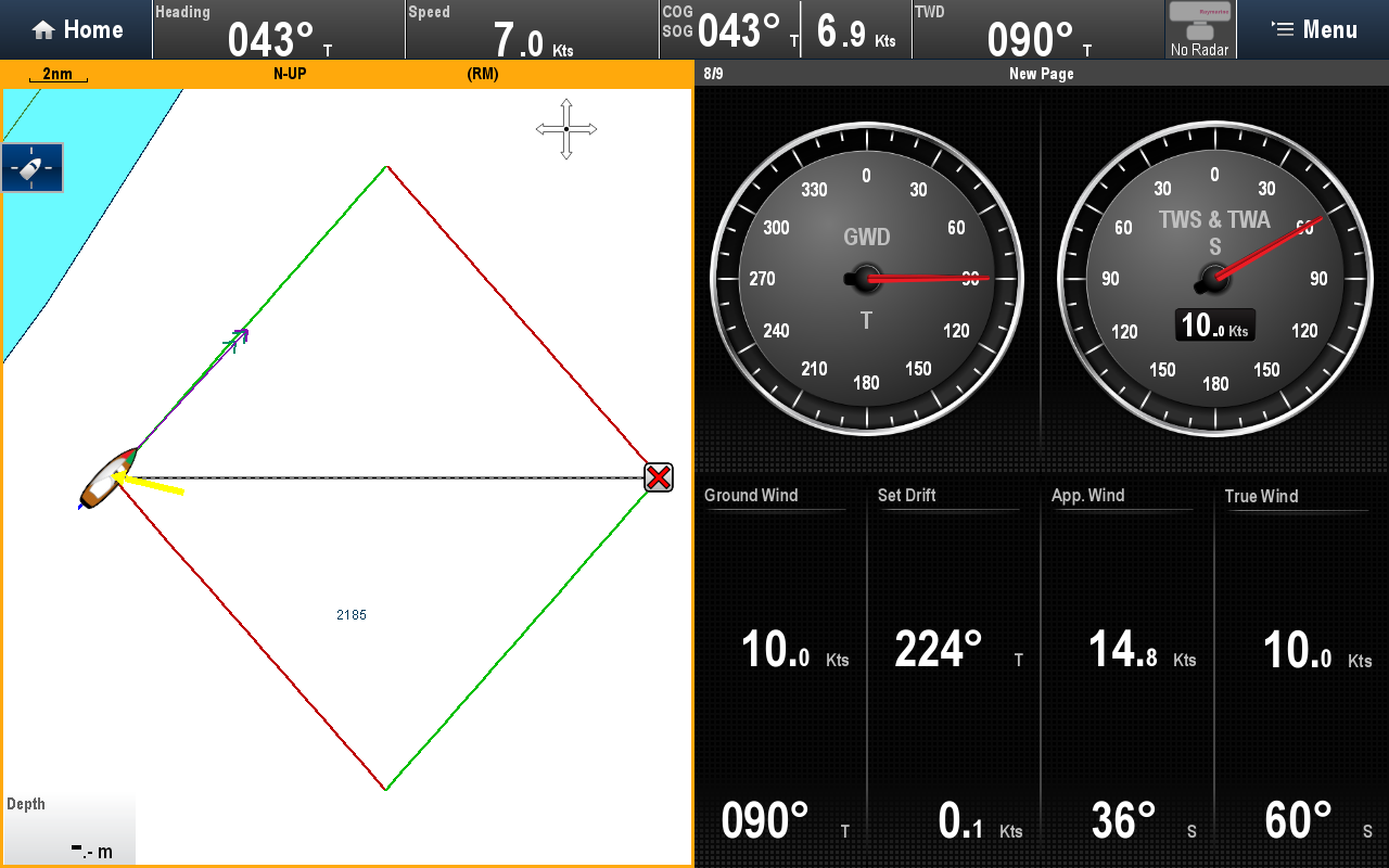
Scenario: You are sailing east from Sydney Harbour in an easterly breeze (Ground Wind 090° True) and a strong southerly current. The first image shows the situation without current:
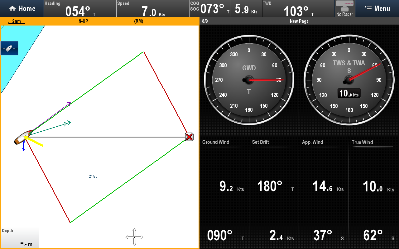
With a 2+ kn southerly current, the difference becomes clear. If you steer by Ground Wind, you risk ending up in the no-go zone. Sailing by True Wind provides the correct course:
For best sailing performance: use True Wind for course and Apparent Wind for sail trim.